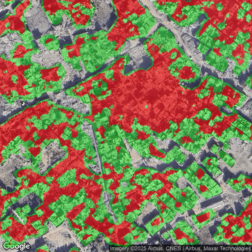
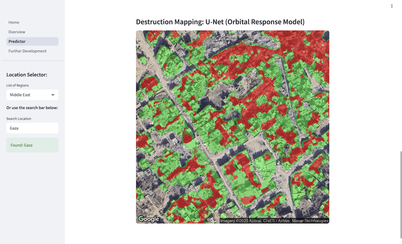
A platform for building damage assessment from satellite imagery, with a mission to optimise the distribution of humanitarian aid in conflict zones. The platform leverages a deep learning architecture comprising two sequential U-Net models—each with its own encoder-decoder structure. Our immediate focus is Gaza, where the architecture is trained on a custom dataset of 150 manually labelled images (~300 m², 1024×1024), extracted from six key areas of building destruction across the Gaza Strip. The current output is a segmentation mask in which each pixel is assigned one of the following classifications: No Building, Building – Undamaged, or Building – Damaged. When overlaid onto the post-disaster image, this produces a visual and geographical damage assessment map covering 600 m² per tile. We are now looking to build on this output to quantify humanitarian aid needs by integrating population density maps and linear regression models to predict units of shelter, food and water, and medical aid. Future development includes improving accuracy by scaling to 1,000 labelled images (25% of Gaza) and generalising the model to other conflict zones, beginning with Ukraine.

.png)
.png)
No image found.
Demo day video
Tech stack

Python

PyTorch

Ultralytics YOLO

Docker
Google Cloud

Streamlit
Meet the team
Ben Shaw

Christian Miró